
Property types for sale
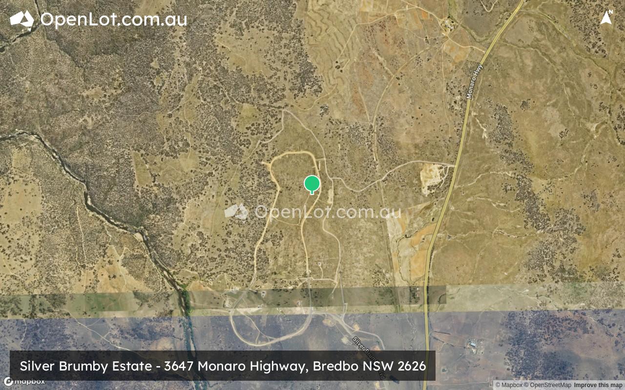
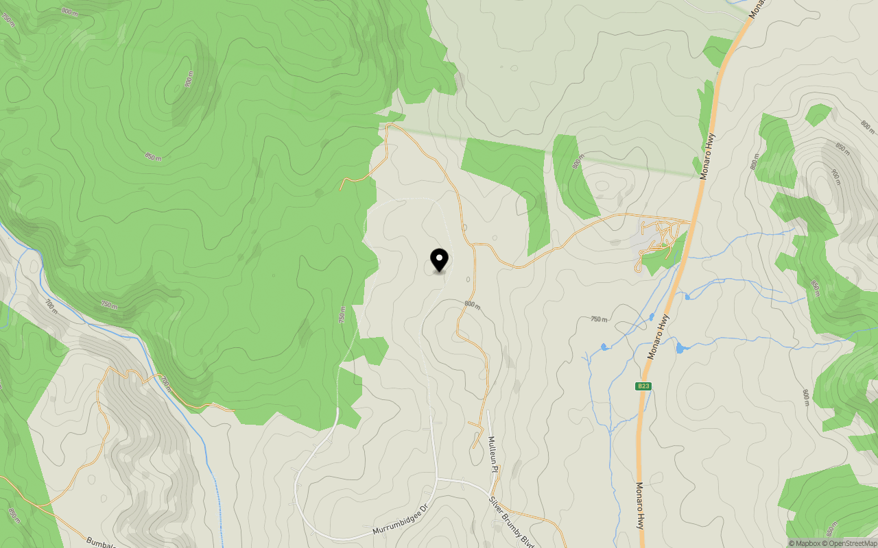
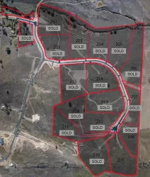
Location & Map for Silver Brumby Estate - Bredbo
Schools near Silver Brumby Estate - Bredbo
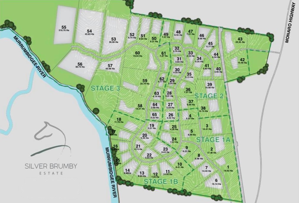
Overview
This information is estimated by the OpenLot research team. Let us know here to provide up-to-date information about this development.
| Total new homes | |
| Area Size | 995.81 hectares |
| City Council | Snowy Monaro Regional Council |
| Developer | N/A |
| Project Marketer | The Westend CBR |
| Creative Agency | Throttle Media |
| Distance to |
Popular Estates near Silver Brumby Estate - Bredbo


Not exactly what you're looking for? Try surrounding suburbs
Googong NSW 2620
9 estates | Queanbeyan-Palerang Regional Council
57.7km north
Burra NSW 2620
1 estate | Snowy Monaro Regional Council
43.7km north
Tralee NSW 2620
2 estates | Queanbeyan-Palerang Regional Council
59.2km north
Royalla NSW 2620
1 estate | Queanbeyan-Palerang Regional Council
51.9km north
Berridale NSW 2628
5 estates | Snowy Monaro Regional Council
56.7km south-west
Cooma NSW 2630
3 estates | Snowy Monaro Regional Council
32.7km south
Latest published articles


FAQs about Silver Brumby Estate - Bredbo
Silver Brumby Estate - Bredbo consists of 65 homes.
The total area for Silver Brumby Estate - Bredbo is 995.81 hectares.
Silver Brumby Estate - Bredbo falls under Snowy Monaro Regional Council.
Silver Brumby Estate - Bredbo is 69 km south of Canberra CBD.
The Westend CBR is the project marketer for Silver Brumby Estate - Bredbo.
Nearby schools for Silver Brumby Estate - Bredbo:
- Bredbo Public School - 3.3km south
- Michelago Public School - 24.6km north
- Monaro High School - 32.3km south
- Cooma North Public School - 32.4km south
- Snowy Mountains Christian School - 32.7km south