
$577,948
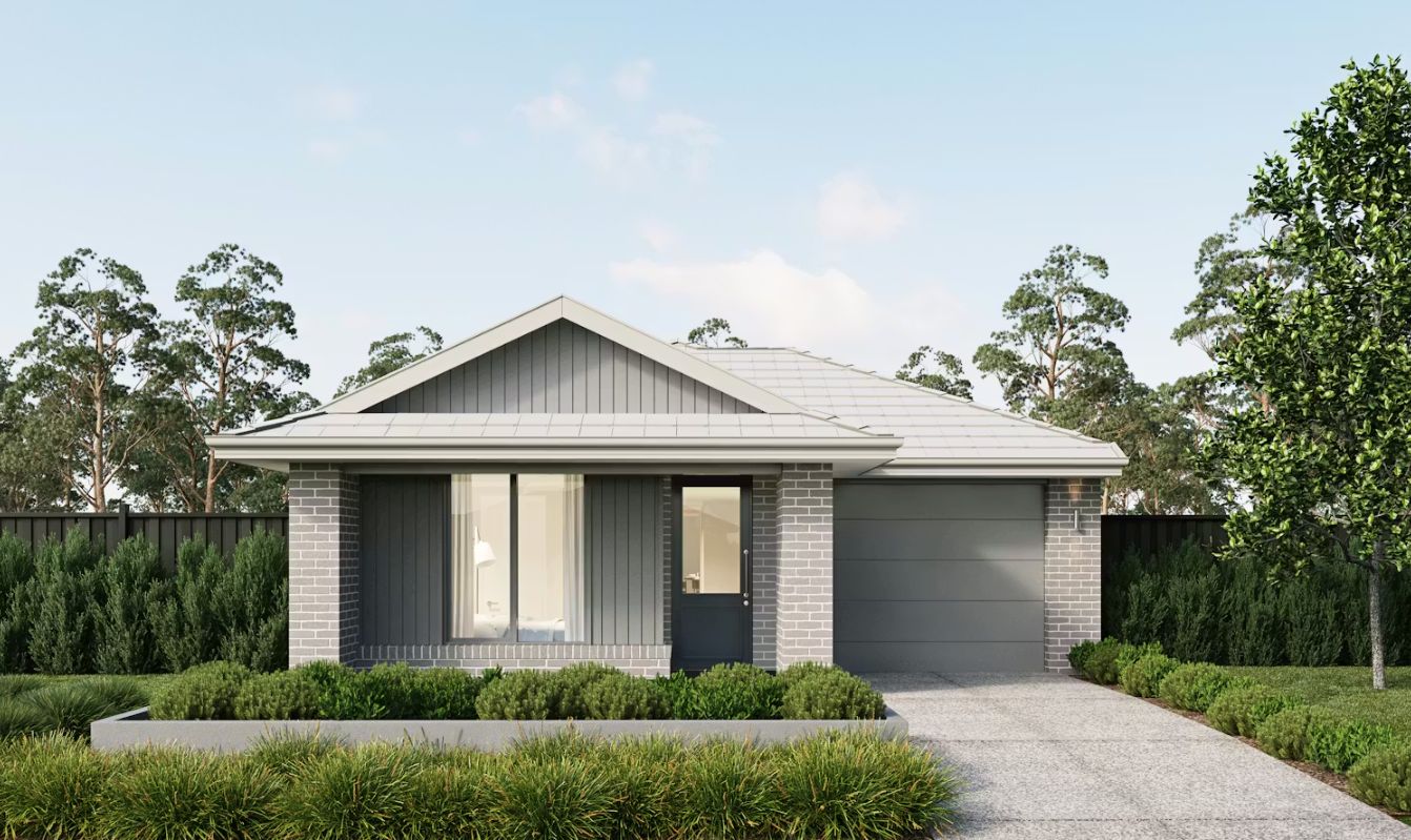
Lot 1033 @ Stockland Lyra Estate


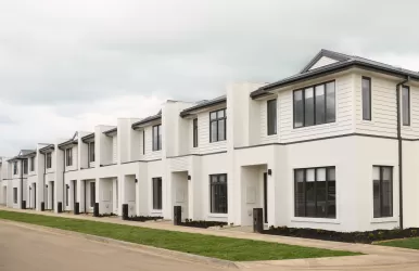
Builder Inclusions
2550mm ceilings to ground floor
7-Star energy rating
Fixed price site costs
Aluminium double glazed windows
Developer and Council requirements
Lifetime structural guarantee
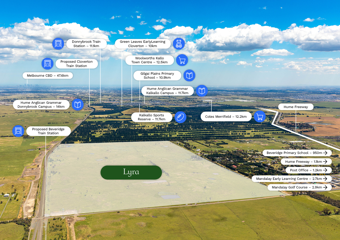
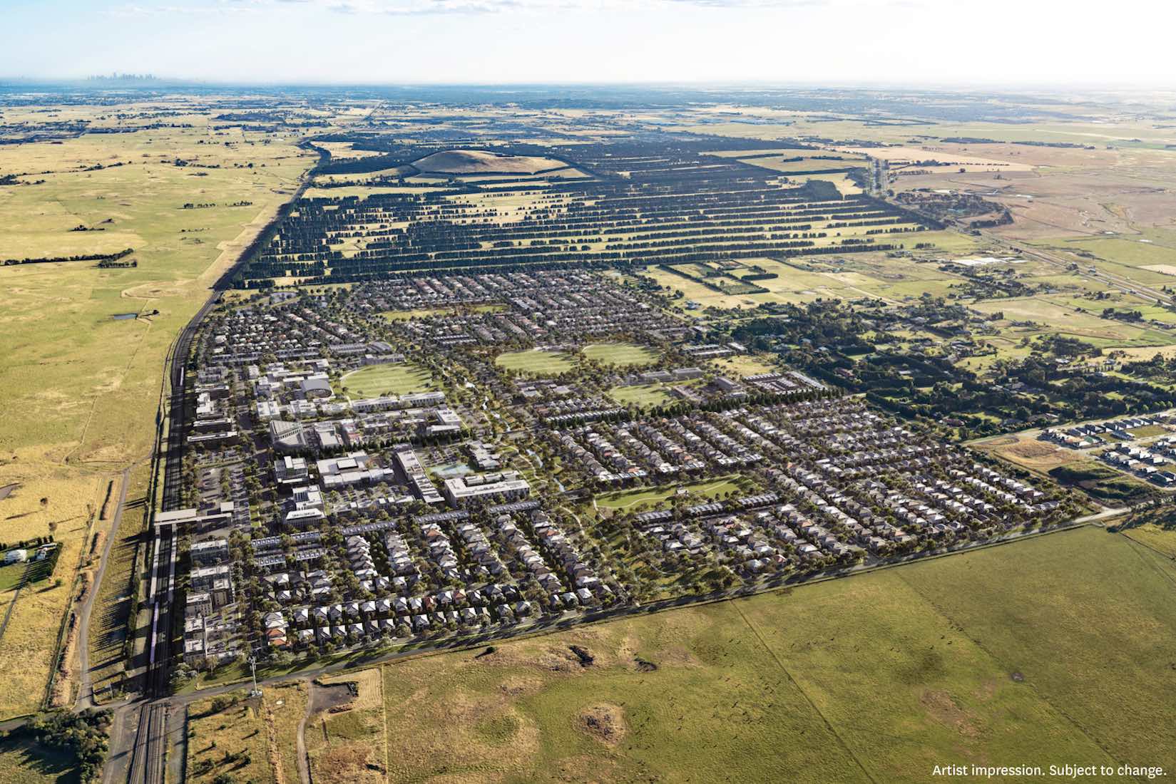
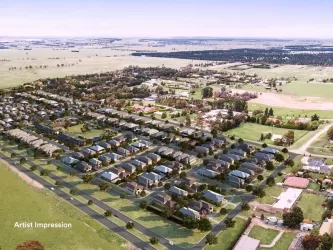
About Stockland Lyra - There's room to dream big at Lyra
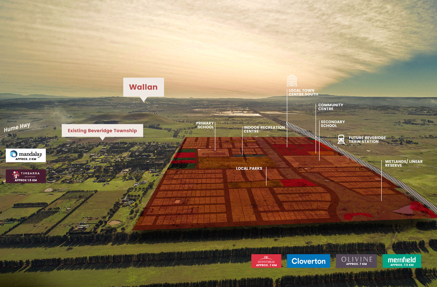
Imagine your busy life made easy with everything you need close by. At Lyra, convenience is yours from the day you move in. A range of supermarkets, schools, and transport links are already here - a short drive from home.
And you have plenty to look forward to with the proposed Beveridge train station and retail town centre, plus two proposed government schools right here at Lyra.
There's a lot to love at Lyra.
About the Developer - The Stockland Story
For more than 70 years, we have been creating and curating communities with people at the heart of the places we create.
As one of Australia’s largest diversified property groups, we are building on our legacy, helping more Australians achieve the dream of home ownership and creating places and spaces full of energy, soul and life - from residential and land lease communities, through to retail town centres, workplaces and logistics assets.
Our purpose - a better way to live - is central to everything we do.
*Price correct at time of publication and is subject to change without notice or obligation. Applies to selected House & Land Package only. Subject to availability. Stockland is only responsible for the sale of the land. Price is based on the Builder’s standard plans and specifications, standard inclusions and preferred building surveyor. Price does not include stamp duty, registration fees, additional costs that may be incurred under the Building Contract (e.g. due to delays in titling the lot) or any other incidental fees associated with the acquisition of land or a home or the construction of a home. The images on this web page are for illustrative purposes only and may depict features (such as landscaping, fencing and façade elements), items or inclusions which are excluded from the price. For more information, speak to a Stockland Sales Professional.
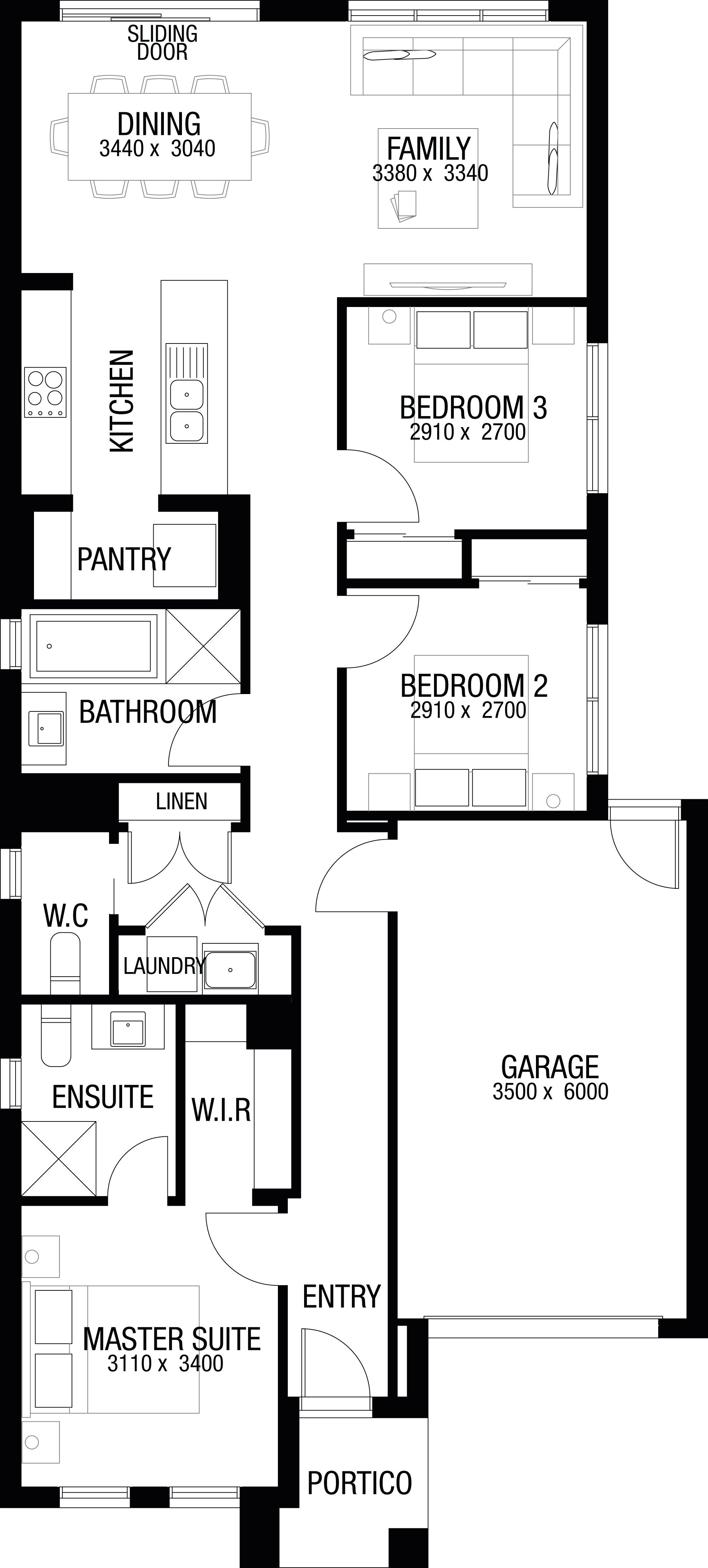
Property overview
- Beds
- 3
- Baths
- 2
- Car Spaces
- 1
- House area
- 137m²
- Land area
- 263m²
- Builder
- Metricon Homes
- Home Design
- Murchison 15A
- Orientation
- West
Local information in Beveridge VIC 3753
5 Land Lots in Stockland Lyra Estate - Beveridge
2 House and Land Packages in Stockland Lyra Estate - Beveridge
Suburb Planning Review in Beveridge VIC 3753
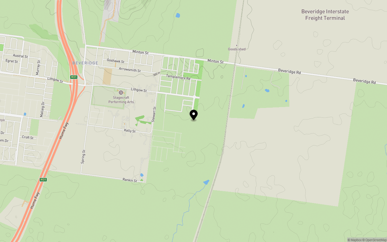
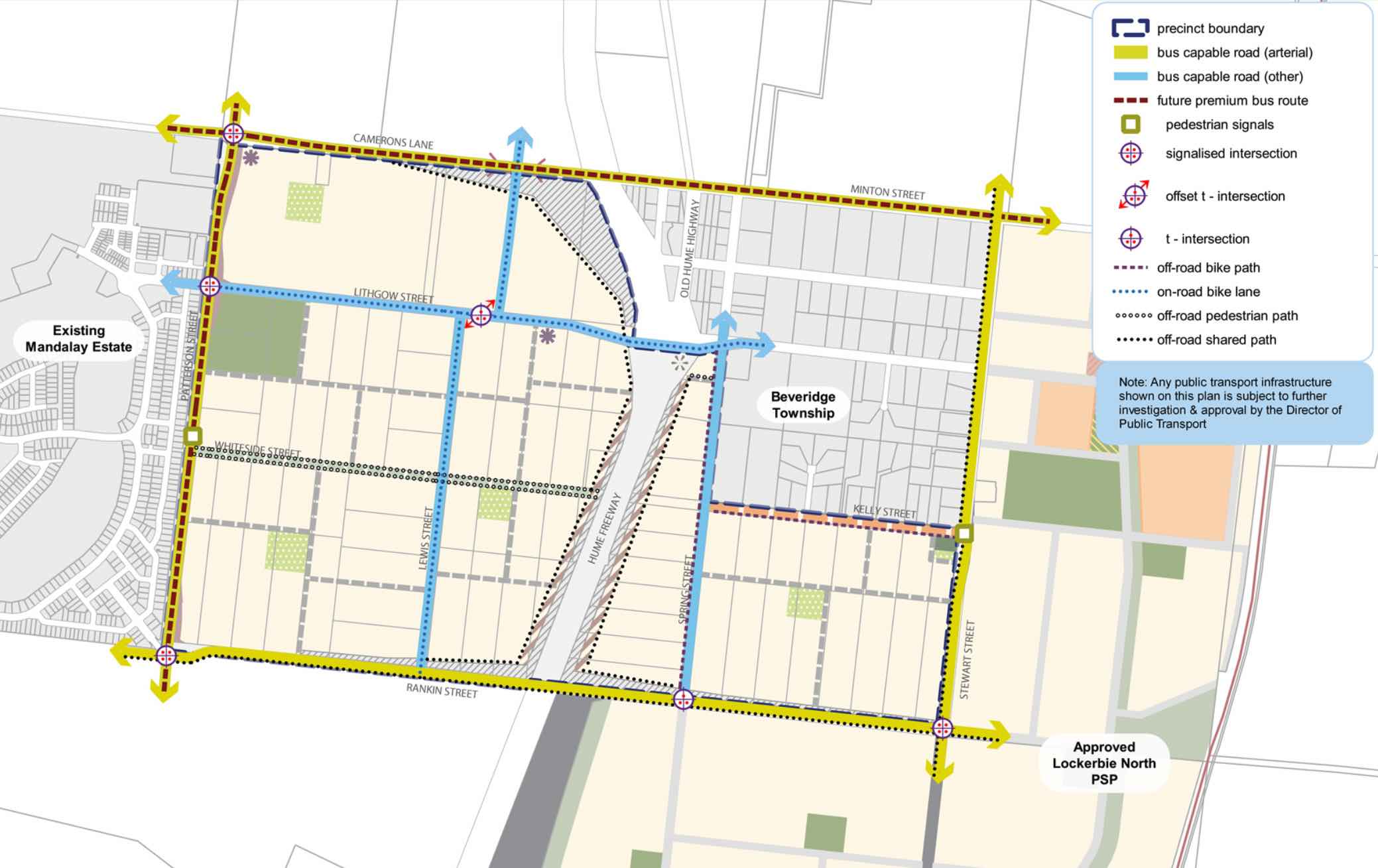
Beveridge is within the Mitchell Shire, located 42 kilometres north of Melbourne and the rural-residential township forms part of the Urban Growth Boundary. The Beveridge growth area is approximately 291.97ha, which is located to the south and west of the existing Beveridge Township on either side of the Hume Highway.
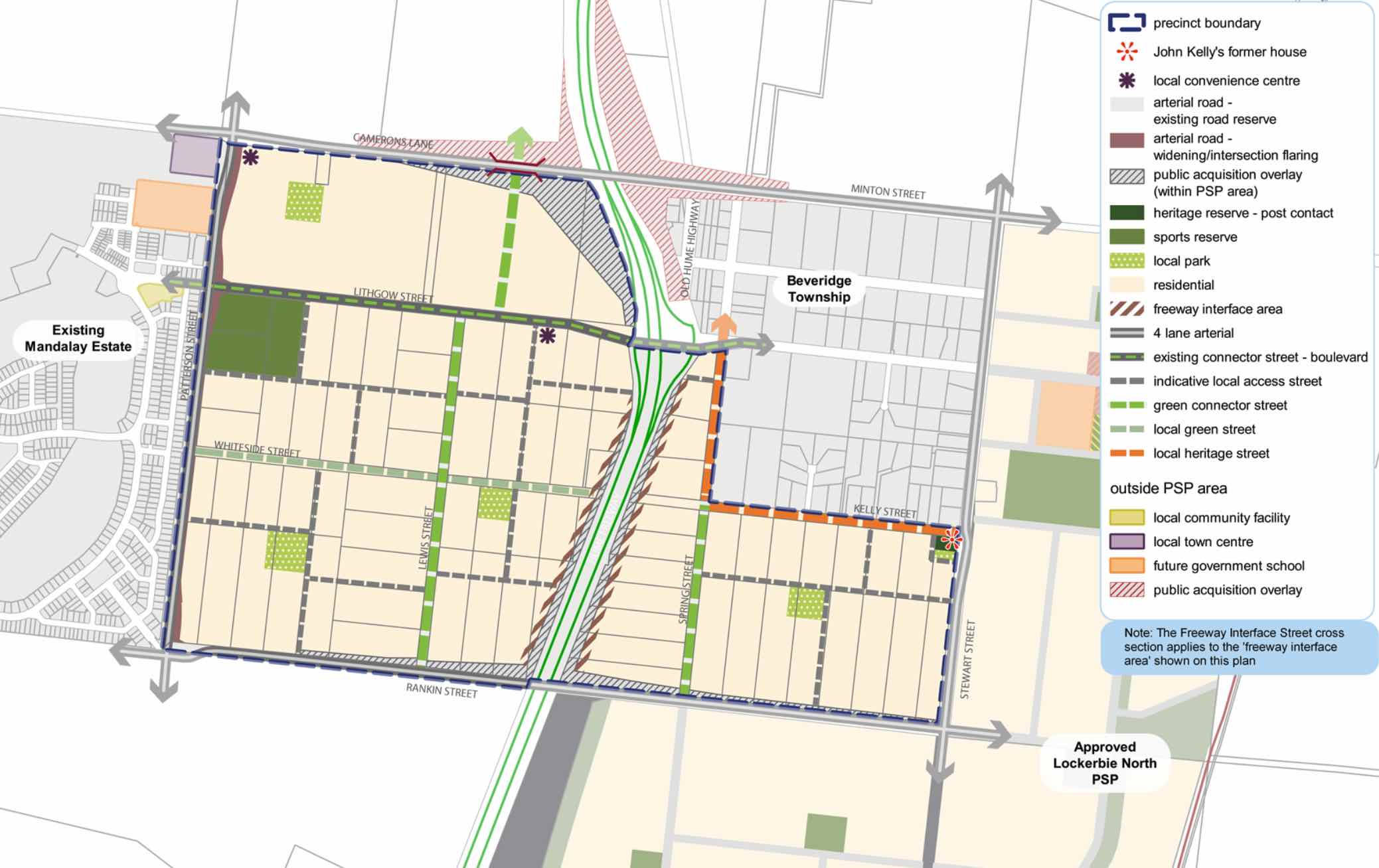
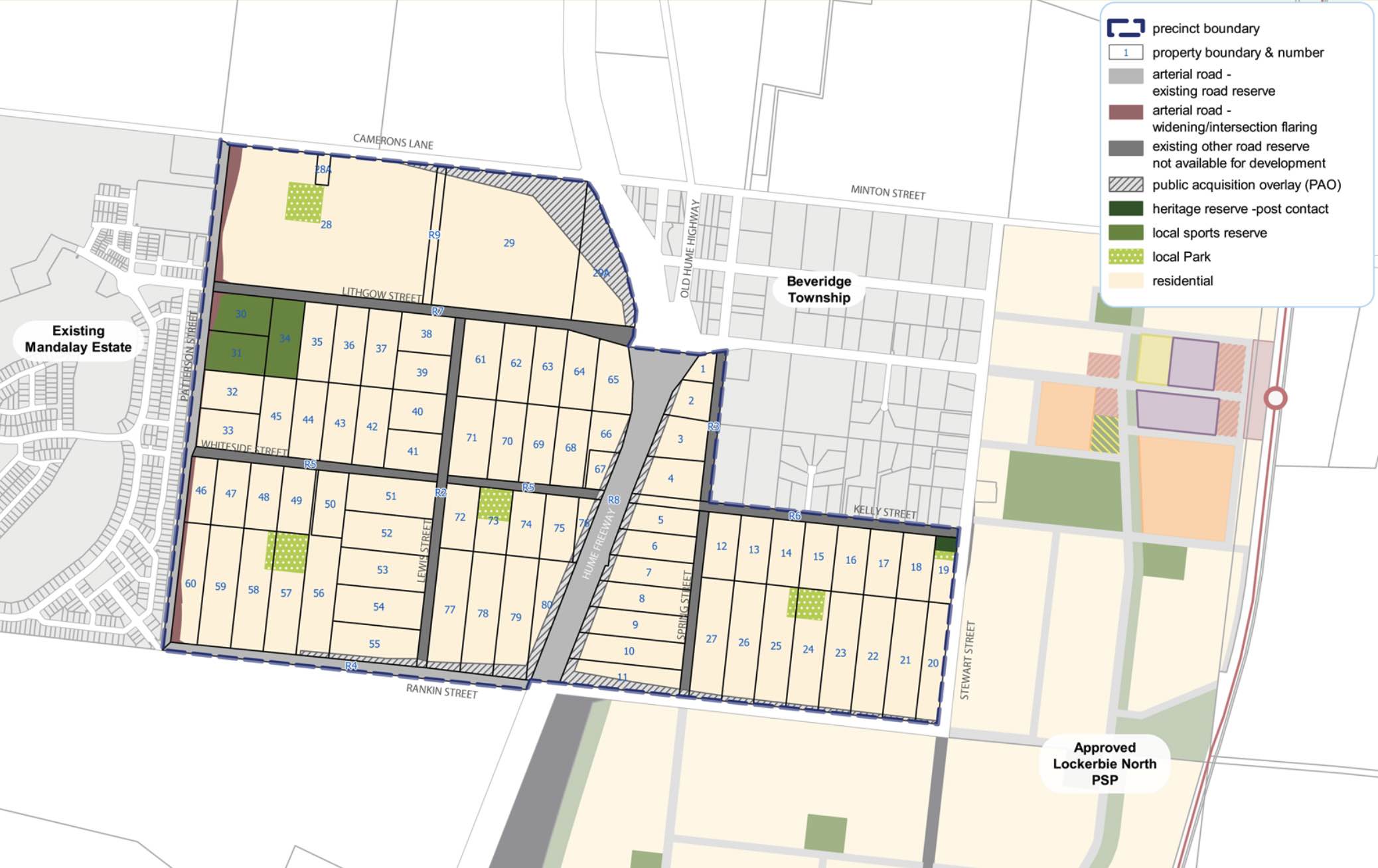
The new suburb is bounded by the existing Mandalay Estate (Patterson Street) to the west, Camerons Lane to the north, Beveridge Township to the north east, Rankin Street to the south and Stewart Street to the east.
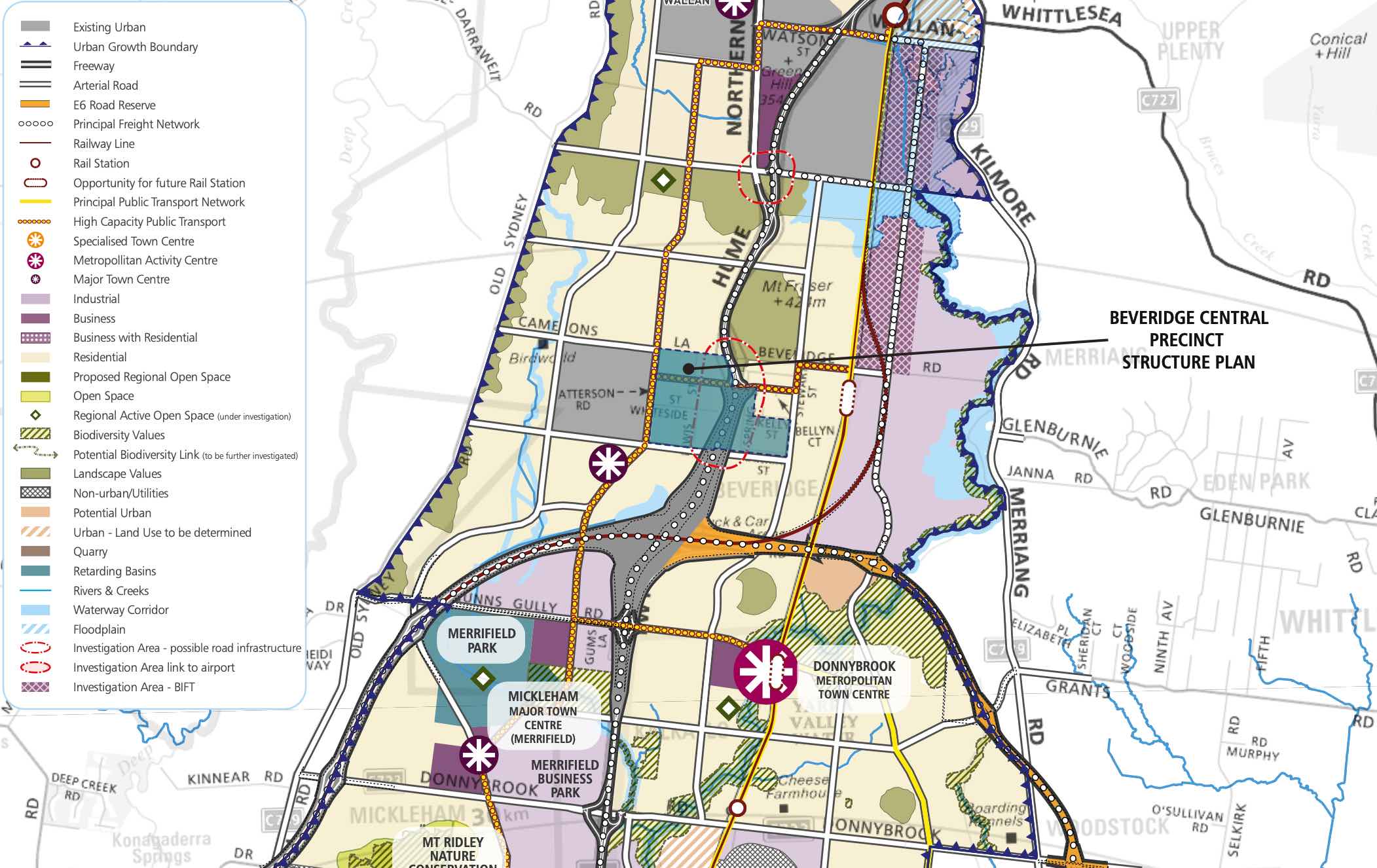
The Beveridge Central Precinct Structure Plan (PSP) was prepared to guide the redevelopment of two future neighbourhoods separated by the Hume Freeway to provide residential neighbourhoods linked by a network of pathways that connect local parks, reserves and convenience centres.
The eastern side of the Hume Highway will integrate with the existing Beveridge Township and the western side will be connected to the existing Mandalay estate and future precincts of Beveridge North-West and Beveridge South-West.
Beveridge also has a current investigation area to the North West of the existing township. The Victorian Planning Authority (VPA) is preparing a draft Beveridge North West Precinct Structure Plan to introduce the amendment into the Mitchell Planning Schemes. The aim is to have the final decision on the PSP shared publicly by August 2022.
The Beveridge Central PSP was prepared by Victorian Planning Authority (VPA) in consultation with the Whittlesea City Council and Mitchell Shire Council and was approved by the Minister for Planning in December 2018. The decision was officially gazetted in January 2019 under Amendment GC55 to the Mitchell and Whittlesea Planning Schemes.
The Vision of Beveridge
“Beveridge Central is a precinct that builds upon the existing sense of community and history of the Beveridge Township while reinforcing its social and physical connections to newer development occurring in this part of the North Growth Corridor”.
“Beveridge Central is expected to change from a rural-residential community into a well serviced, urban community defined by two future neighbourhoods bisected by the Hume Freeway. The eastern side will have a strong relationship with the existing Beveridge Township and development in the Lockerbie North precinct; the western side connecting to the future Beveridge North-West and Beveridge South-West precincts and existing Mandalay estate. There is a focus on creating a high amenity landscape character by featuring extensive landscaping opportunities and green streets within the existing wide road reserves”.
“A cycling and pedestrian path network along streets will connect key destinations such as local parks, the sporting reserve and convenience centres. Highlighting the precinct’s heritage features provides a sense of place for future residents through the preservation and enhancement of Aboriginal and post-contact heritage places and provides mechanisms to ensure the ongoing protection of these places”.
“To service the needs of future residents the precinct will be connected to social and community infrastructure in immediate neighbouring areas. The neighbourhood infrastructure needs of the community will be largely met within the precinct itself, with high quality open spaces and a sports field. Shopping and commercial services will be readily accessible immediately adjacent to the precinct in new town centres in Mandalay and Lockerbie North, with small scale retail needs provided by two local convenience centres within the precinct”.
“In the longer term, the precinct will be accessible to higher-order services, shopping and jobs at the Beveridge Major Town Centre to the southeast of the precinct. Beveridge Central Precinct will have strong transport connections to key destinations via the Hume Freeway, a potential new railway station at Beveridge, and the future Outer Metropolitan Ring (OMR) road, approximately 2km to the south”.
Benefits of Beveridge
The existing zoning will be amended to provide for Urban Growth Zones, providing a series of local parks in proximity to new residential areas and two local convenience centres. The surrounding precincts will provide social, retail and community infrastructure for the new community.
Local shopping, services and employment will be provided within the Beveridge Major Town Centre found in the Beveridge South-West precinct and key industrial employment opportunities within the Northern Corridor.
The Precinct Structure Plan supports the new residential community, protection of heritage places and facilitates the future setbacks for the Hume Highway upgrade.
.jpeg)
Transportation in Beveridge
Beveridge will be connected to public passenger transport, with a future train station to be built in Lockerbie, located to the east outside the Beveridge Township boundary. The passenger train service connects Melbourne to Sydney and is being considered for a high speed rail project.
The suburb will include a network of shared paths, linking the local parks and a new road network. Land acquisition is provided to Camerons Lane and Rankin Street to facilitate intersection upgrades to the Hume Highway, providing a direct connection to Melbourne CBD or northern Victoria.
Beveridge Suburb Summary
| Suburb | Beveridge, Mitchell Shire |
| City / State | Melbourne, Victoria |
| Suburb Area | 291.97ha |
| Boundary |
|
| Suburb inclusions |
|
| Community Amenity | Heritage area and general residential area, with local parks |
| Location | North Melbourne, 42 km from Melbourne CBD |
| Education | None |
| Types of Residential |
|
| Employment Areas | Retail and Commercial, Schools, Community Centre |
| Infrastructure |
|
| Transportation |
|
| Recreation Areas |
|
| Heritage |
|
| Settlement Pattern | Green Field |
References
- Mitchell Shire Council
- Victoria Planning Authority – Planning Schemes
- Victoria Planning Authority
- Victoria Planning Authority – Beveridge Central PSP
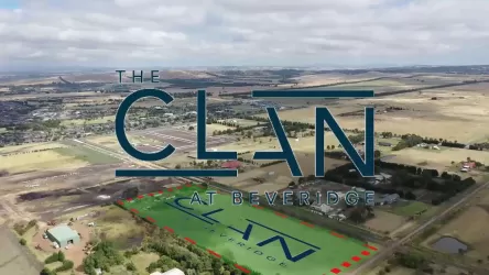
Stockland Lyra Beveridge Video
Estate overview
This information is estimated by the OpenLot research team. Let us know here to provide up-to-date information about this development.
| Total new homes | |
| Area Size | 132.31 hectares |
| Growth Region | Melbourne North Growth Corridor |
| City Council | Mitchell Shire Council |
| Developer | Stockland |
| Distance to | |
| OpenLot Offer | $200 Cashback |
Updates for Stockland Lyra Estate - Beveridge


Builder overview
For more than 50 years, Metricon has been helping Australians love where they live. As Australia’s leading home builder for ten years in a row, we’ve built our reputation on thoughtful design, quality craftsmanship and a genuine commitment to creating homes people are proud to call their own.
We don’t just build houses. We design homes that bring families together, filled with comfort, personality and a sense of belonging. Every home we create reflects our belief that everyone deserves a place they truly love to live.
Nearby schools in Stockland Lyra Estate - Beveridge
There are 6 schools registered in this area on ACARA 2024
FAQs about Stockland Lyra Estate - Beveridge
Stockland is the developer behind Stockland Lyra Estate - Beveridge.
Stockland Lyra Estate - Beveridge consists of 1,400 homes.
The total area for Stockland Lyra Estate - Beveridge is 132.31 hectares.
Stockland Lyra Estate - Beveridge falls under Mitchell Shire Council.
Stockland Lyra Estate - Beveridge is 38 km north of Melbourne CBD.
Nearby schools for Stockland Lyra Estate - Beveridge:
- Beveridge Primary School - 1.3km north-west
- Our Lady of the Way Catholic Primary School - 6.0km north
- Wallan Secondary College - 6.5km north
- Donnybrook Primary School - 6.6km south
- Gilgai Plains Primary School - 6.8km south-west
- Wallan Primary School - 7.4km north
Land Price Trend in Beveridge VIC 3753
Below shows the price trend from vacant land sales recorded in Beveridge VIC 3753.
The data and information provided by Terralytics (Aust) Pty Ltd (Terralytics Data) is general in nature and is not intended to constitute professional advice. Read more
It should not be relied upon as a substitute for legal, financial, valuation, or other specialist advice relevant to your specific circumstances.
Terralytics uses commercially reasonable endeavours to ensure the Terralytics Data is current and accurate. However, as the Terralytics Data incorporates information sourced from third parties, Terralytics makes no representation or warranty — express or implied — as to its accuracy, completeness, or currency. To the maximum extent permitted by applicable law, Terralytics excludes all liability for any loss or damage (including consequential loss) arising out of or in connection with reliance on the Terralytics Data, whether arising in contract, tort (including negligence), statute, or otherwise.
Popular Estates near Stockland Lyra Estate - Beveridge


Not exactly what you're looking for? Try surrounding suburbs
Kalkallo VIC 3064
7 estates | Hume City Council
6.3km south-west
Wallan VIC 3756
22 estates | Mitchell Shire Council
7.2km north
Whittlesea VIC 3757
3 estates | Whittlesea City Council
13.0km east
Woodstock VIC 3751
4 estates | Whittlesea City Council
9.5km south-east
Mickleham VIC 3064
19 estates | Hume City Council
12.5km south-west
Donnybrook VIC 3064
20 estates | Whittlesea City Council
7.2km south


